The habitats of North America
Every species in this guide is tied to the habitats where it occurs most in North America. The arrangement follows the USNVC, the vegetation classification shared by the United States and Canada, with CMECS added for sea and coast and the cultural branch for farmland and built-up land. Ten main groups, from sea to city, and forty-four formations below them. A bird carries at most five: not everywhere it has ever been seen, but where it truly belongs.
Select a habitat to read its description.
Sea A
The Sea major group covers the marine environment of North America, from the tidal zone to the open ocean and the pack ice. The classification follows CMECS and counts five formations: tidal flats, rocky intertidal shore, kelp forest and shallow seabed, open ocean, and sea ice. They differ in substrate, depth, and exposure to air and light, and therefore in the birds that feed there. Together they carry the shorebirds, seabirds, and ice-associated species that this guide links to the sea.
-
 Tidal flats A1
Daniel's Flats, Nieuw-Brunswick · Taxiarchos228 · CC BY-SA 3.0
84 species
Tidal flats form the intertidal zone of exposed sand, silt, and mud, without continuous vegetation cover — this sets the formation apart from the rocky intertidal shore (A2), underlain by solid rock, and from the dry shore above the drift line (B1), not flooded daily. In North America such flats stretch along sheltered bays, as at Daniel's Flats, New Brunswick, where the ebb tide exposes the flat over hundreds of metres. For birds this is prime feeding ground: shorebirds such as Dunlin and Sanderling probe for worms and shellfish, American Avocet and both oystercatchers forage by sight, and White Ibis and Roseate Spoonbill work the shallow, muddy water.
-
 Rocky intertidal A2
Yaquina Head, Oregon · Gary Halvorson, Oregon State Archives · CC BY 4.0
41 species
The rocky intertidal shore consists of solid rock and boulders that fall dry and flood twice daily — this sets it apart from the soft substrate of tidal flats (A1) and from the permanently submerged kelp forest (A3), which begins only below the low-water line. In North America this shore occurs along the Pacific coast, as at Yaquina Head, Oregon, where wave action forms a banded zone of seaweed. For birds the rock offers grip and food: American Oystercatcher and Black Oystercatcher pry loose shellfish, Belted Kingfisher dives for fish from the edge, and Tufted Puffin uses the shore as a breeding site.
-
 Kelp forest and shallow seabed A3
Cojo Anchorage, Californië · Robert Schwemmer, NOAA · Public domain
18 species
Kelp forest and shallow seabed is the permanently submerged, light-reached bottom on which large brown algae root — this makes the formation deeper than the emergent rocky intertidal shore (A2), and shallower and bottom-bound compared with the open ocean (A4), where no seabed lies within reach. In North America Macrocystis pyrifera forms underwater forests along the Pacific coast, as at Cojo Anchorage, California, where the fronds reach the water surface. For diving birds it is a productive layer: Northern Gannet and Brown Booby plunge-dive at the kelp edge, while Tufted Puffin and Horned Puffin pursue fish underwater.
-
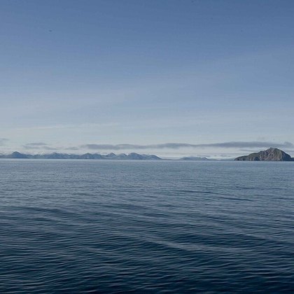 Open ocean A4
Aleoeten, Alaska · Hillebrand Steve, U.S. Fish and Wildlife Service · Public domain
117 species
Open ocean is the water column far from shore, where no seabed lies within reach of light or diving — this sets the formation apart from the bottom-bound kelp forest (A3) and from sea ice (A5), where a frozen layer seals off the water. CMECS divides the marine system by depth into a nearshore, an offshore, and an oceanic zone, and this formation covers the last of these. In North America the open ocean extends beyond the continental shelf, as off the Aleutian Islands, Alaska. Birds here are adapted to a pelagic existence: Black-footed Albatross, Leach's and Wilson's Storm-Petrel, Pomarine Jaeger, Common Loon, and Hawaiian Petrel range over the open water in search of food.
-
 Sea ice A5
Tsjoektsjenzee bij Utqiaġvik, Alaska · USFWSAlaska · Public domain
16 species
Sea ice is frozen seawater that seals the water surface as a floating or landfast pack — this sets the formation apart from the open ocean (A4), where the water stays freely accessible, and from glaciers and land ice, which sit on solid ground and are not formed from frozen seawater. In North America sea ice covers large parts of the Chukchi Sea and adjoining Arctic waters, as at Utqiaġvik, Alaska, where ice fringes the coastline for much of the year. The ice edge, where the pack gives way to open water, matters for birds: food concentrates there as it is carried to the surface, which generally draws species that forage over open water and along ice edges, even though no species is specifically linked to this formation.
Coast B
The coast group covers the habitats where land and sea meet, from the tideline to the first stable vegetation inland. It comprises five formations: dunes and sandy beaches, sea cliffs, salt marsh, mangrove, and estuaries and lagoons. These formations differ sharply in substrate and tidal influence, but all share constant exposure to wind, salt and wave action. For birds the coast is a narrow but productive strip: breeding ground for colonial nesters, foraging habitat for shorebirds and fish-eaters, and a link in the continental migration route.
-
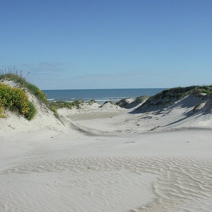 Dunes and sandy beaches B1
Padre Island, Texas · Public domain
85 species
Dunes and sandy beaches are the bare to lightly vegetated sand coast above the average high-tide line, from open beach to the first dune vegetation inland. Unlike salt marsh (B3) the substrate stays sandy and dry rather than clayey and regularly flooded, and unlike sea cliffs (B2) there is no exposed bedrock; the daily tidal flooding found on the tidal flat is also absent here. Along the Atlantic coast, American beachgrass (Ammophila breviligulata) builds foredunes on barrier islands, with Uniola paniculata taking over farther south. For birds it is both breeding and resting ground: American Oystercatcher, Sanderling, Dunlin and Brown Pelican breed, forage or roost here, while Snow Bunting and Lapland Longspur winter in the sparse dune vegetation.
-
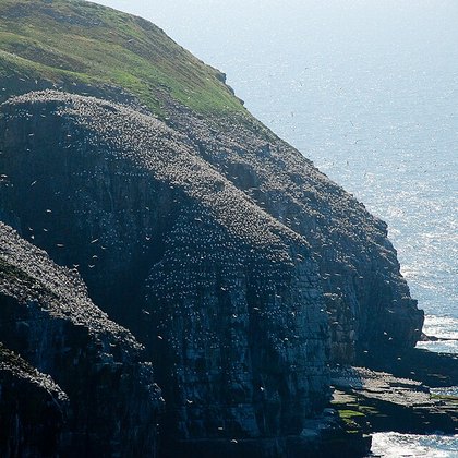 Sea cliffs B2
Cape St. Mary's, Newfoundland · Johnath · CC BY-SA 3.0
87 species
Sea cliffs are steep, largely bare rock formations directly exposed to surf and salt-laden wind, from the breaker zone to the edge of the plateau above. They differ from dunes (B1) in lacking loose sand and from salt marsh (B3) in lacking fine sediment; vegetation is limited to moss, lichen and scattered low shrubs rooted in rock crevices. Such cliffs occur from Alaska to Oregon on the Pacific coast, and at sites like Cape St. Mary's, Newfoundland, on the Atlantic side. For birds they are essential colony sites: Northern Gannet, Horned and Tufted Puffin, Double-crested Cormorant and Leach's Storm-Petrel nest here in dense colonies, while Peregrine Falcon uses the ledges as a nest site.
-
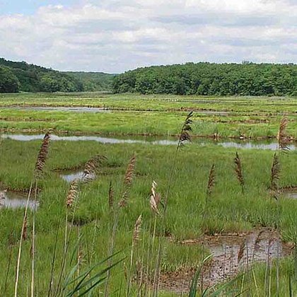 Salt marsh B3
East Lyme, Connecticut · Alex756 · CC BY-SA 3.0
84 species
Salt marsh is vegetated, regularly tide-flooded marsh on fine, clayey sediment along sheltered coasts and estuaries. It differs from dunes (B1) in its daily flooding and clay rather than sandy substrate, and from mangrove (B4) in its herbaceous rather than woody cover — mangrove replaces salt marsh south of roughly central Florida. From the Bay of Fundy to Texas, Spartina alterniflora dominates the lowest, daily-flooded zone, with Spartina patens and salt pannes higher up. For birds the marsh is essential foraging and breeding habitat: American Avocet, Black-necked Stilt, Dunlin, Great Egret and Red-winged Blackbird are abundant, while species such as Roseate Spoonbill and White Ibis forage along its creeks.
-
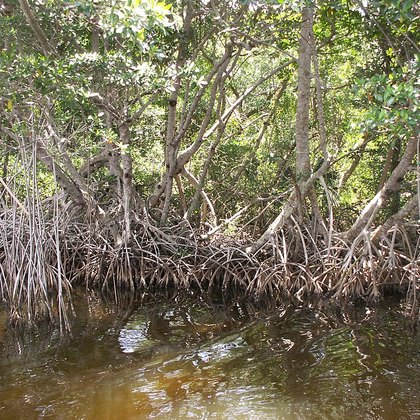 Mangrove B4
Buttonwood Canal, Everglades, Florida · Moni3 · Public domain
48 species
Mangrove is the woody, tide-dependent forest of salt-tolerant trees that replaces salt marsh (B3) in the subtropical and tropical coastal zone, chiefly in southern Florida and the Caribbean. Unlike herbaceous salt marsh, cover consists of trees with prop or pneumatophore roots; unlike estuaries (B5) the ground is fixed forest rather than open water. Red mangrove (Rhizophora mangle) forms the outer, most tide-exposed fringe on stilt roots, with black mangrove (Avicennia germinans) and white mangrove (Laguncularia racemosa) further inland in less-flooded basins. For birds the dense canopy provides colonial breeding habitat: Wood Stork, White Ibis, Great Egret, Roseate Spoonbill and Brown Pelican nest here, while Anhinga forages among the roots.
-
 Estuaries and lagoons B5
Copper River Delta, Alaska · Forest Service Alaska Region, USDA · Public domain
169 species
Estuaries and lagoons are the semi-enclosed, brackish transitional waters where rivers meet the sea or where barrier islands close off a strip of coastal water — CMECS classifies this as the Estuarine System, with an open tidal connection to the sea and measurable freshwater input. They differ from open salt marsh (B3) in being open water themselves, and from mangrove (B4) in lacking fixed woody shoreline vegetation. Examples range from Chesapeake Bay to the Copper River Delta in Alaska. For birds these waters are among the richest on the coast: American White Pelican, Osprey, Bald Eagle, Common Loon and Eared Grebe, plus numerous other grebes, cormorants, gulls and jaegers, forage, roost or winter here in large numbers.
Inland water C
Inland water covers every freshwater system on the North American continent, from still to flowing water and from the shoreline to the artificially built basin. The group splits into four formations: lakes and ponds, rivers and streams, the surrounding riparian zone, and constructed waters such as reservoirs and irrigation ponds. Together they form the habitat of fish-eating birds, divers, waders and songbirds that depend on open water or on the trees and shrubs along the waterline.
-
 Lakes and ponds C1
Little Gabro Lake, Minnesota · Dankarl · CC BY-SA 4.0
130 species
Lakes and ponds are standing waterbodies that hold water year-round, from a small pool to an extensive lake. The border with rivers and streams (C2) lies in the current, largely absent here; the riparian zone (C3) begins where trees and shrubs take over the shoreline; constructed waters (C4) form a separate formation despite a similar look, because human hands dug or dammed them. In North America this ranges from glacially carved boreal lakes in Minnesota, ringed by conifer forest, to shallow lakes farther south. Loons such as the Common Loon, grebes such as the Pied-billed Grebe, raptors such as the Osprey and the Bald Eagle, and waterfowl such as the Mallard find open water to fish, dive, or rest.
-
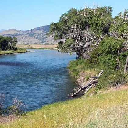 Rivers and streams C2
Paradise Valley, Montana · Warrenfish · Public domain
68 species
Rivers and streams are flowing waters, distinguishing them from the standing lakes and ponds (C1); a river dammed into a reservoir falls under constructed waters (C4) instead. The riparian zone (C3) is the land directly along the bank, while the channel itself, with its current and bed of gravel or rock, belongs to this formation. In North America this ranges from fast mountain rivers such as in Paradise Valley, Montana, to slow lowland rivers. On rocks in the swiftest stretches, attached aquatic plants sometimes grow, a sign of stable, clear current. The American Dipper dives here for prey, the Belted Kingfisher hunts from a branch above the water, and the Osprey and the Bald Eagle fish over the rapids.
-
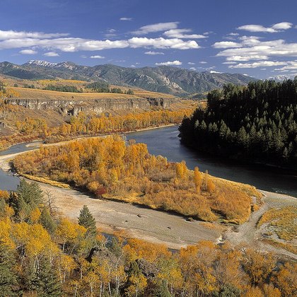 Riparian zone C3
South Fork van de Snake River, Idaho · Bureau of Land Management · Public domain
230 species
The riparian zone is the vegetated strip along lakes (C1) and rivers (C2), where willows, cottonwoods and other broadleaf trees form the transition between open water and drier ground. At constructed waters (C4) this strip is often absent, since the fluctuating water level there prevents tall woody growth. In the western United States the riparian zone, such as along the South Fork of the Snake River in Idaho, forms a narrow band of Populus woodland amid much drier surroundings. Shade, insects and berries draw a broad range of songbirds: the Ruby-throated Hummingbird, the Northern Cardinal, the Cedar Waxwing and the Red-eyed Vireo breed or forage here, while the Great Blue Heron and the Osprey use the nearby water.
-
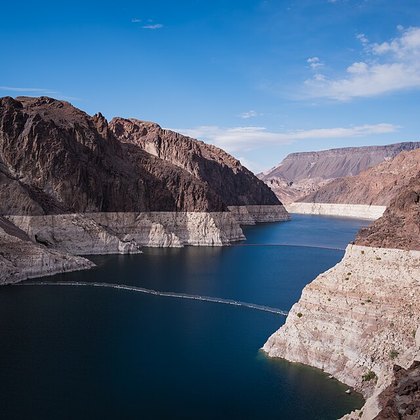 Reservoirs and ponds C4
Lake Mead, Nevada · Christian David · CC BY-SA 4.0
81 species
Constructed waters are human-dug or dammed waterbodies such as reservoirs, irrigation ponds and stock ponds; what sets them apart from natural lakes and ponds (C1) is their origin and fluctuating water level, which usually prevents a stable riparian zone (C3) from forming. A dammed river (C2) falls under this formation below the dam wall. In North America, Lake Mead in Nevada, impounded by the Hoover Dam, is an extreme example: a vast waterbody with bare shorelines exposed by drawdown, set amid an otherwise dry desert. Such waters draw shorebirds and waterbirds: the American Avocet and the Black-necked Stilt forage the exposed banks, while the American White Pelican, the Eared Grebe and the Osprey use the open water to fish.
Mires and marshes D
Group D covers the freshwater wetlands of North America where the soil is saturated year-round or for much of the year, from acidic peatlands to open marsh, wet meadow, and flooded forest. The group is divided into peatland and muskeg, freshwater marsh, wet meadow and sedge marsh, and swamp forest, each defined by its own water regime, soil chemistry, and standing vegetation. For birds these habitats provide nesting cover in dense growth, foraging in shallow water, and, in peatland and swamp forest, shelter that open water and grassland lack.
-
 Peatland and muskeg D1
Kupreanof Island, Alaska · Stepheng3 · CC BY-SA 3.0
58 species
Peatland and muskeg is an acidic, Sphagnum-covered wetland: nutrient-poorer than the freshwater marsh (D2), treeless or with only stunted trees compared with the closed-canopy boreal conifer forest (G2), and lacking the open water of lakes and ponds (C1). In North America this type ranges from Alaska to the Great Lakes, with the most extensive bog systems in southeastern Alaska, as on Kupreanof Island: hummocks and hollows covered in Sphagnum, small cranberry and bog-laurel, with scattered stunted black spruce. Migrating Parasitic Jaegers and Pomarine Jaegers pass over these coastal bogs on the way to their Arctic breeding grounds; in Alaska the Rustic Bunting has also been recorded here as a vagrant.
-
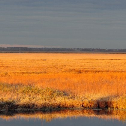 Freshwater marsh D2
Horicon Marsh, Wisconsin · U.S. Fish and Wildlife Service - Midwest Region · Public domain
127 species
The freshwater marsh is a shallow, nutrient-rich wetland with standing emergent vegetation, less acidic than the peatland (D1), and holding water longer than the briefly saturated wet meadow (D3); against open lakes (C1), dense stem vegetation defines it, not open water. In North America it ranges from the Great Lakes to the prairie potholes of the northern Great Plains, with Horicon Marsh in Wisconsin an example: cattail and bulrush stands in water from a few centimeters to about a meter deep. For birds it is a nursery and foraging ground for herons such as the Great Egret, ducks such as the Mallard, marsh birds such as the American Coot and the Sandhill Crane, and songbirds such as the Red-winged Blackbird.
-
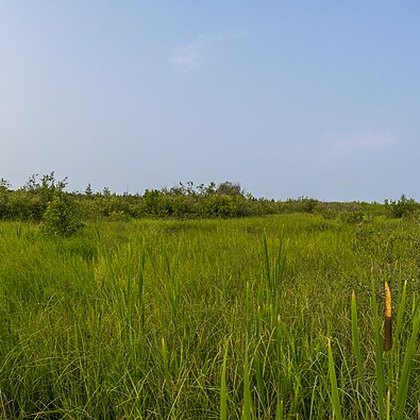 Wet meadow and sedge marsh D3
Lake Noquebay, Wisconsin · wackybadger · CC BY-SA 2.0
103 species
Wet meadow and sedge marsh is briefly and shallowly saturated compared with the freshwater marsh (D2), with a low cover of sedges and grasses rather than tall emergent reeds, and wetter than the drier tallgrass prairie (E1) and managed pastureland (I4) it grades into. In North America this type lies mainly in the transition zone between the Great Lakes and the boreal region, as at Lake Noquebay in Wisconsin: tussocks of Carex sedges and wet-prairie grasses on ground that floods in spring and stays damp through summer. Geese such as the Canada Goose and the Cackling Goose graze and nest here, the Red-winged Blackbird breeds in the low cover, and the Lapland Longspur visits such damp flats on migration.
-
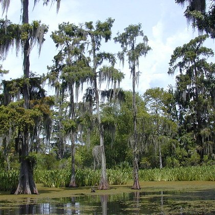 Swamp forest D4
Zuid-Louisiana · Jan Kronsell · CC BY-SA 3.0
57 species
Swamp forest is a closed-canopy forest on permanently to seasonally flooded ground, distinct from the open freshwater marsh (D2), which lacks a tree layer, and from the dry deciduous forest (G1), which does not flood; against the narrow riparian corridor along rivers (C3), swamp forest forms an extensive, continuous forest type. In North America it is characteristic of the southern coastal plain, as in southern Louisiana: bald-cypress (Taxodium distichum) with knee roots and water tupelo stand in permanent water, draped in Spanish moss. For birds this type offers nesting sites high in the canopy and foraging ground in the flooded understory, with species such as the Anhinga, the Wood Stork, and the Carolina Wren.
Grasslands E
The Grassland major group covers North America's open, grass-dominated landscapes, where trees are absent or only scattered. Within the USNVC the group falls largely under the Temperate Grassland & Shrubland Formation. Four formations are distinguished: tallgrass prairie, shortgrass prairie and steppe, alpine meadow, and savanna with open oak woodland — a sequence running from moist, tall prairie through dry steppe to treeless alpine tundra and half-open oak woodland. For birds these open expanses offer ground-nesting opportunities, clear sightlines against predators, and an abundant supply of seeds and insects.
-
 Tallgrass prairie E1
Flint Hills, Kansas · Public domain
35 species
Tallgrass prairie is the moistest of the grassland formations: tall, dense C4 grasses on deep soils, without the scattered oaks of savanna (E4). Moving west, where soils grow drier and shallower, the vegetation gradually gives way to the lower, more open shortgrass prairie (E2). In North America tallgrass prairie once stretched from southern Manitoba to the Gulf coast of Texas; major remnants survive in the Flint Hills of Kansas. Grasses such as Andropogon gerardii and Sorghastrum nutans reach well over two meters by late summer, with under ten percent tree cover. The dense growth shelters the Northern Bobwhite, while the Common Nighthawk hunts above the grass canopy and the Brown-headed Cowbird favors the open, grazer-influenced edges.
-
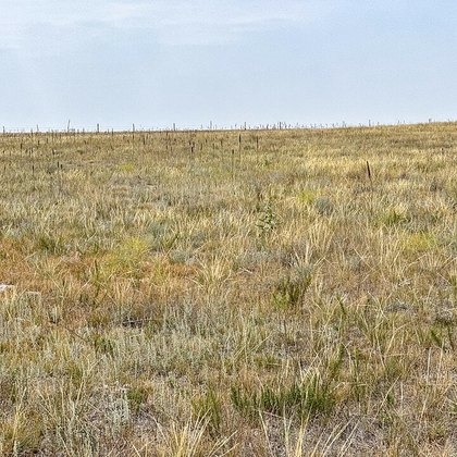 Shortgrass prairie E2
Dawes County, Nebraska · Z3lvs · CC0
94 species
Shortgrass prairie and steppe is North America's driest grassland: short, hardy grasses on shallow soil, occurring where rainfall is too low for the tall grasses of tallgrass prairie (E1) and relief too low for alpine meadow (E3). It spans the western Great Plains from southeastern Alberta to Nebraska and Wyoming; the dossier anchors it at Dawes County, Nebraska. Grasses such as Bouteloua gracilis and Hesperostipa comata form a sparse sod rarely more than a few decimeters tall, interspersed with low shrubs. The wide, open plain draws ground-nesting Horned Larks and Killdeer, hunting Red-tailed Hawks, and, in winter, northern visitors such as the Snow Bunting and the Snowy Owl.
-
 Alpine meadow E3
Flat Tops, Colorado · Lvaughn7 · CC BY-SA 4.0
24 species
Alpine meadow is the treeless vegetation above timberline: low, cushion-forming plants and short graminoids on rocky, frost-worked soil, where conditions are too harsh for the conifer forest or shrubland below. In North America this zone lies in the Rocky Mountains, from New Mexico to Alberta, with a photo site in the Flat Tops of Colorado; the guide also places Hawaii's high volcanic slopes within this type. Plants such as Geum rossii and Silene acaulis form a fine mosaic of dense turf and bare ground. The open, windswept heights draw the American Pipit as a breeder; the Northern Wheatear and Rufous Hummingbird forage there, and the Hawaiian Petrel and Nene use the volcanic version of this habitat.
-
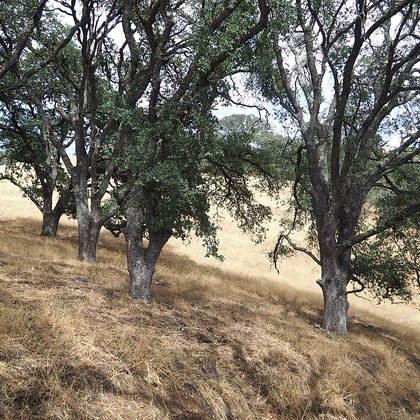 Savanna and oak woodland E4
Mount Diablo, Californië · Awinch1001 · CC BY 4.0
136 species
Savanna and oak woodland is the half-open tree vegetation between grassland and closed forest: scattered, broad-crowned oaks over a grass understory, kept open by regular light fire. The boundary with tallgrass prairie (E1) lies where the first trees appear, while denser canopy closure marks the gradual shift into closed oak forest. In North America this type ranges from California — the dossier anchors it at Mount Diablo — to the eastern states, with species such as Quercus douglasii and Quercus lobata as low-branching trees five to fifteen meters tall. The open structure draws the Wild Turkey and Northern Bobwhite as ground foragers, the Red-tailed Hawk hunting from treetops, and cavity nesters such as the Northern Flicker and White-breasted Nuthatch.
Scrub and tundra F
This macrogroup gathers low, woody to semi-woody vegetation that cold, drought or repeated disturbance keeps from closing into forest. It spans the treeless arctic tundra, the drought-adapted chaparral and sagebrush steppe of the west, the krummholz and dwarf scrub above treeline, and the thickets and woodland edges of the east. For birds this low, often berry-bearing cover provides shelter and food close to the ground, attracting ground-nesting species, shrubland birds, and species of open, bare terrain.
-
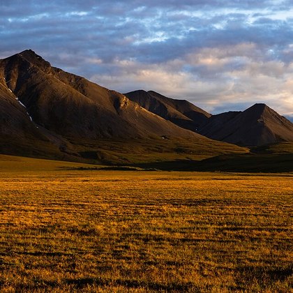 Arctic tundra F1
Galbraith Lake, Brooks Range, Alaska · USFWSAlaska · Public domain
103 species
Arctic tundra is the treeless vegetation north of and above the treeline, on permanently frozen ground. Its boundary with krummholz and dwarf scrub (F4) lies at the treeline itself, where stunted trees give way to a cover of dwarf shrubs, sedges and mosses; farther south the tundra passes into closed boreal forest. In North America it stretches across northern Alaska and the Brooks Range, with low willows, Dryas, cottongrass tussocks and lichens over a short growing season on permafrost. This open, flat vegetation supports ground-nesting shorebirds such as Dunlin and Sanderling, jaegers such as Parasitic Jaeger and Pomarine Jaeger, Snowy Owl, Snow Bunting, Lapland Longspur, Horned Lark and Northern Wheatear.
-
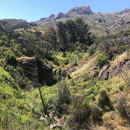 Chaparral F2
Santa Monica Mountains, Californië · Artemizzia · CC BY 4.0
39 species
Chaparral is the dense, evergreen shrub vegetation of California's Mediterranean climate, with hard, small leaves. Its boundary with sagebrush steppe (F3) lies in climate and composition: chaparral grows in the wetter coastal strip and low mountains, sagebrush steppe in the cold, dry interior dominated by Artemisia. Where the shrubs grow taller and close ranks, chaparral passes into oak woodland. In North America it covers the slopes of the Santa Monica Mountains and similar California ranges up to about 2,000 meters, forming dense, nearly impenetrable stands of chamise (Adenostoma fasciculatum), Ceanothus and manzanita, adapted to periodic fire. The shrubs provide cover for Greater Roadrunner, Bushtit, Wrentit and Phainopepla.
-
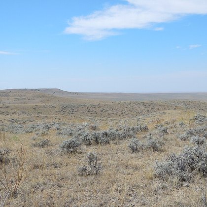 Sagebrush steppe F3
bij Jordan, Montana · Matt Lavin · CC BY-SA 2.0
38 species
Sagebrush steppe is the cold, dry interior shrub-steppe dominated by Artemisia species such as big sagebrush. It differs from chaparral (F2) in its cold, dry interior climate rather than the moist Mediterranean coastal climate, and from krummholz and dwarf scrub (F4) in occurring at lower, warmer elevations, below the subalpine belt. In North America it covers vast, open plains from the Great Basin to the northern Great Plains, such as near Jordan, Montana, with a sparse, grey-green shrub layer of knee-high sagebrush over thin soils. This open, low-growing vegetation offers little cover and mainly attracts birds adapted to bare, arid ground and scattered shrubs.
-
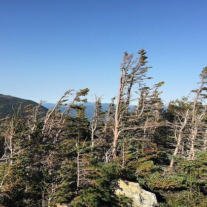 Krummholz and dwarf scrub F4
Mount Washington, New Hampshire · Famartin · CC BY-SA 4.0
36 species
Krummholz and dwarf scrub is the wind-sheared, stunted vegetation just above the treeline of high mountains: dwarfed spruces and firs mixed with a heath-like layer of dwarf shrubs. Below this belt stands closed subalpine conifer forest; above it the vegetation thins into bare, rocky alpine fellfield without woody cover. Unlike arctic tundra (F1), which lies at sea level in the far north, this formation results from elevation rather than latitude. In North America it occurs on peaks such as Mount Washington, New Hampshire, and in ranges from Alaska to the Rocky Mountains, with spruces and firs pruned by wind and ice into shrub form. The scattered, sheltered clumps of trees and shrubs hold Siberian Accentor, Northern Shrike, Arctic Warbler and Northern Wheatear.
-
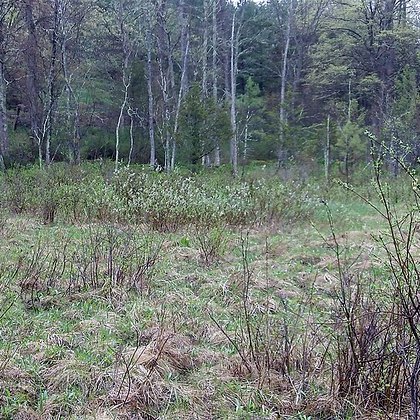 Thickets and woodland edge F5
Cape Cod, Massachusetts · U. S. Fish and Wildlife Service - Northeast Region · Public domain
363 species
Thickets and woodland edge cover the dense, mostly low vegetation of shrubs, young trees and vines along forest margins, hedgerows and regenerating clearings. Unlike the climate-bound formations chaparral (F2), sagebrush steppe (F3) and krummholz (F4), this is a structural, often transitional stage: where the canopy closes it becomes forest, where the shrub layer thins out it leaves open grassland or farmland. In North America the formation ranges from coastal shrubland on Cape Cod, Massachusetts — important habitat for the New England cottontail — to comparable shrub and edge habitat across the continent and in Hawaii. The dense, often berry-bearing shrub layer provides cover and food for Northern Cardinal, Song Sparrow, Northern Mockingbird, Cedar Waxwing, Mourning Dove, Blue Jay, Black-and-white Warbler and Red-eyed Vireo, among others.
Forest and woodland G
The Forest and woodland group covers the closed- and semi-open tree-dominated vegetation of North America, following the USNVC Forest & Woodland class. Its five formations trace a gradient of moisture and latitude: Deciduous forest in the east, Boreal conifer forest in the far north, Montane and coastal conifer forest along the Pacific ranges, Pinyon-juniper and dry pine woodland in the arid interior, and Subtropical and tropical forest at the southern tip. Together these forests carry the continent's densest canopy and its richest community of cavity nesters, nuthatches, woodpeckers and canopy warblers.
-
 Deciduous forest G1
Rock Creek Park, Washington D.C. · Katja Schulz · CC BY 2.0
159 species
Deciduous forest covers the broadleaf forests of the eastern and central continent, with a canopy that colors and drops each autumn. Northward it grades into Boreal conifer forest, where spruce and balsam fir replace maple and beech; westward into the drier Pinyon-juniper and dry pine woodland, and on wet ground into Swamp forest, while a narrow fringe is called Thickets and woodland edge. Sugar maple, American beech (Fagus grandifolia) and basswood form the core, as at Rock Creek Park near Washington, D.C., on nutrient-rich, glacially formed soil. Its canopy holds bark-climbers such as the White-breasted Nuthatch and Brown Creeper, songbirds such as the Red-eyed Vireo and Black-and-white Warbler, and cavity nesters such as the Black-capped Chickadee.
-
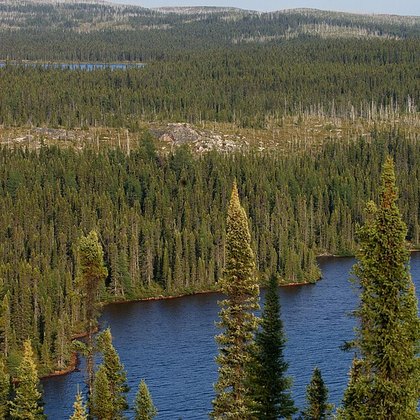 Boreal conifer forest G2
Quebec, Canada · peupleloup · CC BY-SA 2.0
116 species
Boreal conifer forest is the predominantly evergreen conifer forest of the far north, dominated by spruce, balsam fir and birch. Northward it thins into the scattered trees of Arctic tundra; southward Deciduous forest takes over. Wet basins within this forest are treated separately as Peatland and muskeg, and at the ridge crest it gives way to the wind-formed Krummholz and dwarf scrub. Photographed in Quebec, where black spruce and jack pine form the boreal taiga stretching to Alaska, with a ground layer of mosses, lichens and blueberry on acidic, nutrient-poor soil. These conifer stands draw the Red-breasted Nuthatch, the Brown Creeper and the Golden-crowned Kinglet, in clearings the Northern Shrike, and as irregular winterers the Siberian Accentor and Rustic Bunting.
-
 Montane and coastal conifer forest G3
Olympic National Park, Washington · Miguel.v · Public domain
127 species
Montane and coastal conifer forest covers the conifer forests of the Rocky Mountains and the Pacific coast, from lowland rainforest to high-mountain forest. It differs from the flatter Boreal conifer forest through relief and, along the coast, through far higher rainfall; upslope comes Krummholz and dwarf scrub and, higher still, Alpine meadow, while on the drier eastern flank Pinyon-juniper and dry pine woodland takes over. Photographed at Olympic National Park, Washington, where giant Douglas-fir, western hemlock and Sitka spruce grow over a floor carpeted with moss and ferns, in one of the wettest climates on the continent. These forests hold the White-breasted Nuthatch, the Red-breasted Nuthatch, the Golden-crowned Kinglet and the Ruby-crowned Kinglet, along the west coast the Rufous Hummingbird, while the Bald Eagle nests here along rivers and shorelines.
-
 Pinyon-juniper and dry pine woodland G4
Elko County, Nevada · Famartin · CC BY-SA 3.0
124 species
Pinyon-juniper and dry pine woodland is the open, low-statured conifer woodland of the dry mountain ranges between the Rocky Mountains and the Sierra Nevada. Downslope comes the shrub cover of Sagebrush steppe, and on the driest ground Desert and semi-desert; upslope the wetter Montane and coastal conifer forest takes over once the pines are replaced by Douglas-fir. Photographed in Elko County, Nevada, where singleleaf pinyon (Pinus monophylla) and Utah juniper form an open canopy no taller than ten meters, on rocky soil between 1500 and 2600 meters elevation. This dry woodland holds the Bushtit and the Phainopepla as characteristic residents, bark-climbers such as the White-breasted Nuthatch, and songbirds such as the Blue-gray Gnatcatcher and Blue Jay.
-
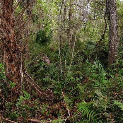 Subtropical and tropical forest G5
Fakahatchee Strand, Florida · Miguel Vieira · CC BY 2.0
171 species
Subtropical and tropical forest covers the frost-free forests of the far south: tropical hardwood hammocks on limestone ridges and the cypress-dominated strand and dome swamp forests of South Florida and Hawaii. The boundary with Swamp forest lies at the transition to open freshwater marsh; along the coast comes Mangrove, and where the forest opens, Savanna and oak woodland. Photographed at Fakahatchee Strand, Florida, where bald cypress (Taxodium distichum) grows in linear strands, bordered by hardwoods such as gumbo limbo and West Indian mahogany on higher ridges, with orchids and bromeliads in the shaded canopy. On the mainland the Plain Chachalaca is characteristic, together with the Coppery-tailed Trogon; on Hawaii the same formation holds an entirely different community, from the Red-crested Cardinal to the endangered Iiwi and Hawaii Amakihi.
Desert and barren land H
This group covers North America's bleakest and driest landscapes, where water, frost or salt prevent a closed plant cover from forming. It splits into four formations: desert and semi-desert (H1), with scattered shrubs and cacti; rock, cliff and talus (H2), from canyon wall to sea cliff; polar desert and glacier foreland (H3), the bare ground left behind by frost and ice; and sand and alkali flats (H4), the dry beds of former lakes. Birds here are adapted to heat, cold or the absence of cover.
-
 Desert and semi-desert H1
Saguaro National Park, Arizona · dconvertini · CC BY-SA 2.0
95 species
Desert and semi-desert is the vegetation of warm, dry lowlands: open shrubs, cacti and drought-tolerant grasses on stable gravel and sand soils, unlike the bare rock of rock, cliff and talus (H2) and the almost unvegetated sand and alkali flats (H4). In North America the formation runs from the Mojave and Sonoran deserts to the Chihuahuan Desert, with Larrea tridentata and Fouquieria splendens as characteristic shrubs and, around Saguaro National Park in Arizona, the saguaro cactus as the defining species; annual rainfall usually stays below 250 mm. Greater Roadrunner, Phainopepla and Black-tailed Gnatcatcher nest in the scrub, while Verdin and Pyrrhuloxia forage there.
-
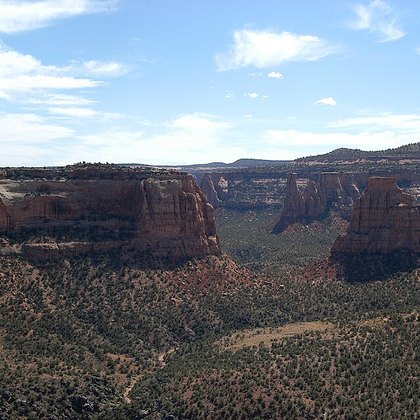 Rock, cliff and talus H2
Colorado National Monument, Colorado · G. Edward Johnson · CC BY-SA 3.0
77 species
Rock, cliff and talus covers sparsely vegetated rock walls, ledges and scree slopes with almost no soil — unlike the shrubs and cacti on stable ground in desert and semi-desert (H1) and the bare, flat surfaces of sand and alkali flats (H4); plant cover here is limited to lichens, cushion plants and occasional crevice specialists. In North America the formation runs from canyon walls on the Colorado Plateau, as at Colorado National Monument, to sea cliffs along the Pacific coast. Peregrine Falcon and American Dipper nest on ledges above canyons and Northern Wheatear among the talus, while coastal cliffs hold colonies of Horned Puffin and storm-petrels.
-
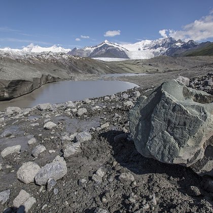 Polar desert and glacier foreland H3
Kennicottgletsjer, Alaska · National Park Service, Alaska Region · Public domain
11 species
Polar desert and glacier foreland covers the bleakest ground of the far north: boulders, scree and fresh glacial debris with less than ten percent plant cover, where mosses and lichens dominate and vascular plants are limited to pioneers such as Draba and Saxifraga species. This sets the formation apart from the less extreme rock, cliff and talus (H2) farther south. In North America it occurs scattered from Alaska across northern Canada, on ground exposed by frost or, as at the Kennicott Glacier in Alaska, by recently retreating ice. Sanderling forages here on passage, Snowy Owl nests on the bare ground and Northern Wheatear settles among the debris.
-
 Sand and alkali flats H4
White Sands National Park, New Mexico · dconvertini · CC BY-SA 2.0
15 species
Sand and alkali flats covers the flat, often bare floors of former lakes and dry playas: fine sediment with a salt or gypsum crust, sometimes fringed by sparse salt-tolerant grasses such as Distichlis spicata, unlike the shrubs of desert and semi-desert (H1) and the rocky, sloping ground of rock, cliff and talus (H2). In North America such flats form the floor of dried basins across the Great Basin and, as at White Sands National Park in New Mexico, extensive gypsum sand and alkali flats. American Avocet and Black-necked Stilt forage along the damp margin after rain, while Horned Lark breeds on the bare, open ground itself.
Farmland and gardens I
In this guide, Group I covers farmland, gardens and other human-managed vegetation outside the built-up town center itself: land that is regularly plowed, mowed, fertilized or otherwise maintained for agriculture or ornament. The group splits into four formations: arable land (I1), gardens and parks (I2), orchard and vineyard (I3), and pasture and rangeland (I4). For birds these areas often form food-rich, open to semi-open sites that differ strongly from the original natural vegetation, with species that specifically benefit from that disturbance and management.
-
 Arable land I1
Noordwest-Iowa · inkknife_2000 · CC BY-SA 2.0
162 species
Arable land is ground that is regularly plowed and sown with annual crops: grain, corn, soybeans and other row crops. It differs from gardens and parks (I2) in scale and the absence of ornamental planting, from orchard and vineyard (I3) in lacking perennial woody crops, and from pasture and rangeland (I4) in that the soil is turned over each year rather than grazed. In North America the largest expanses lie across the Midwest Corn Belt and the wheat fields of the Great Plains, forming large, flat, treeless parcels that run together for miles. Such open expanses draw ground-nesting birds and winter visitors of open country, such as Horned Lark, Snow Bunting, Lapland Longspur, Killdeer, Turkey Vulture and Wild Turkey.
-
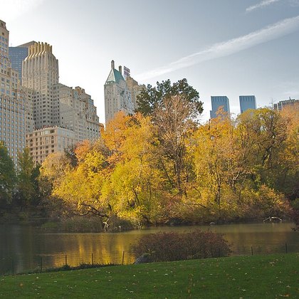 Gardens and parks I2
Central Park, New York · Ed Yourdon · CC BY-SA 2.0
237 species
Gardens and parks covers managed ornamental greenery in and around towns and cities: private gardens, street plantings, city parks, cemeteries and golf courses, with lawn, flower beds and planted trees. It differs from arable land (I1) in that no crop is harvested and the plots are far smaller and more varied, and from orchard and vineyard (I3) in that the trees and shrubs serve an ornamental purpose rather than standing in rows for a fruit or grape harvest. Characteristic of North America are large city parks with mature broadleaf trees set among high-rise buildings, such as Central Park in New York, alongside countless smaller suburban front yards. Such green islands within built-up land attract a wide range of birds, from Northern Cardinal and Blue Jay to House Sparrow, Northern Mockingbird, Northern Flicker and Ruby-throated Hummingbird.
-
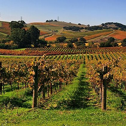 Orchard and vineyard I3
Napa Valley, Californië · Brocken Inaglory · CC BY-SA 3.0
55 species
Orchard and vineyard covers plots of perennial woody crops planted in rows: fruit and nut trees and grapevines. That sets the formation apart from arable land (I1), where annual crops are resown each year, and from gardens and parks (I2), where the planting serves an ornamental purpose rather than a harvest. It also differs from pasture and rangeland (I4), which is open grassland without crop rows. In North America the formation is concentrated in mild-climate regions: apple orchards in Washington State, citrus groves in Florida, and the vineyards of Napa Valley in California with their low, trellis-trained vines set out in rows. The low, dense rows offer cover and perches to species including Cedar Waxwing, Rose-ringed Parakeet, Plain Chachalaca and Northern House Wren.
-
 Pasture and rangeland I4
Oost-Oregon · Garytmarsh · CC BY-SA 4.0
139 species
Pasture and rangeland covers grassland maintained by livestock grazing or by annual mowing for hay. Unlike arable land (I1), the turf here stays intact and the ground is not plowed, and unlike orchard and vineyard (I3), crop rows and woody planting are entirely absent. In North America the formation ranges from the vast cattle ranches on the shortgrass prairie and dry rangelands of the West, as in eastern Oregon, to the smaller hay meadows of the Midwest and East. The result is an open, closely grazed landscape that closely resembles natural grassland but is managed more intensively. Such pastures attract raptors such as Red-tailed Hawk and Turkey Vulture, as well as ground dwellers such as Greater Roadrunner, Killdeer and Northern Bobwhite.
Built and industrial J
Formation Group J covers habitats shaped almost entirely by human use: buildings, infrastructure and industry replacing natural ground and vegetation. The group comprises four formations: town and city (J1), harbour and industry (J2), quarry and mining (J3), and landfill and wastewater (J4) — ranging from inhabited and vegetated to bare and paved. For birds this mainly means a shift: species that naturally nest and forage on rock, cliffs or open ground find an artificial equivalent here, often with abundant food of human origin.
-
 Town and city J1
Layton, Utah · Pink Sherbet Photography · CC BY 2.0
103 species
Town and city is the inhabited, vegetated part of Formation Group J: neighbourhoods, villages and city centres with gardens, lawns, parks and street trees. It differs from harbour and industry (J2) in lacking large-scale industrial grounds, and from quarry and mining (J3) in having vegetated, unexcavated ground. In North America the formation ranges from low-rise neighbourhoods with grid streets, as around Layton, Utah, to densely built downtowns. Buildings offer artificial nest sites — ledges standing in for cliffs, chimneys for hollow trees — while gardens and parks feed House Sparrow, European Starling, American Robin, Northern Mockingbird and Chimney Swift, among others, plus introduced species such as Rose-ringed Parakeet.
-
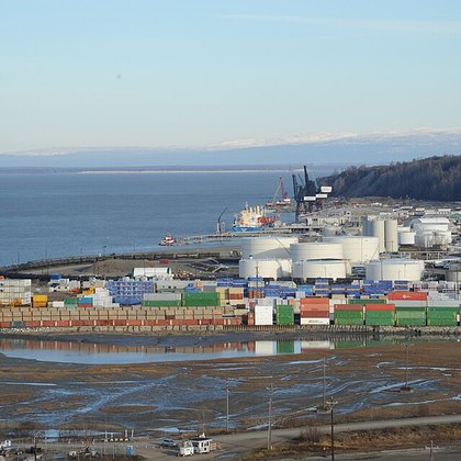 Harbour and industry J2
Haven van Anchorage, Alaska · Wonderlane · CC BY 2.0
29 species
Harbour and industry covers the working, largely unvegetated grounds of Formation Group J: harbours, quays, storage yards, refineries and factory sites. Where J1 still has gardens, here hard paving and artificial substrate dominate — quay walls and riprap replacing natural rock or tidal flat (compare Formation Group A). Against quarry and mining (J3), this formation is about storage and processing, not extraction. In North America it ranges from port cities such as Anchorage, Alaska, to inland warehouse districts. The hard structures serve as artificial cliff for Brown Pelican, Brown Booby, Magnificent Frigatebird and Great Black-backed Gull, while Killdeer uses the bare ground and House Sparrow the buildings.
-
 Quarry and mining J3
Idaho Springs, Colorado · Rsparks3 · CC BY-SA 4.0
6 species
Quarry and mining is the extractive part of Formation Group J: open quarries, gravel pits, surface mines and their steep faces. Unlike harbour and industry (J2), where material is processed, here material is removed from the ground; unlike town and city (J1), vegetation is largely absent and the ground lies bare. The artificial faces resemble natural cliffs but are fresh and unvegetated. In North America the formation ranges from gravel pits to former mining districts such as Idaho Springs, Colorado, with steep, bare walls and water-filled pits. No species in the guide are linked to this formation: bare ground and steep walls chiefly attract birds seeking open terrain and rocky nest sites, and resulting pools offer temporary water to passage birds.
-
 Landfill and wastewater J4
Brookhaven, Long Island, New York · CzarJobKhaya · CC BY 4.0
17 species
Landfill and wastewater is the waste-handling part of Formation Group J: municipal landfills and the basins of sewage treatment plants. It differs from quarry and mining (J3), where material is extracted rather than deposited, and from harbour and industry (J2) in its focus on waste disposal rather than production; settling basins differ from natural marshes in their straight, engineered shape. In North America, active landfills such as the one at Brookhaven, Long Island, form open waste fields over which birds circle, while treatment basins elsewhere provide open water where no natural pool exists. This formation chiefly attracts Great Black-backed Gull and Ring-billed Gull, foraging on refuse, and European Starling, feeding there in large flocks.